|
KING LOOP
Raeremmelga 11 Urban Planning Competition, Tartu
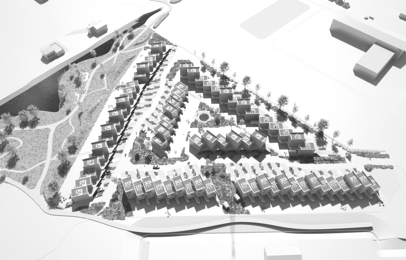
A proposal for the urban planning competition for the Raeremmelga 11 site in Tartu, Estonia, envisioning a new residential neighbourhood integrated with public green space and the adjacent equestrian centre. The competition brief called for a comprehensive spatial vision that would serve as the basis for a future detailed plan, including housing layout, street network, landscape structure and public realm strategy. The proposal was developed as a two-phase implementation strategy, allowing the area to evolve gradually while maintaining a coherent overall spatial identity. The design explores a contemporary row-house neighbourhood shaped by green corridors, shared open spaces and a flood-resilient landscape, creating a coherent living environment closely connected to nature, movement and community life.
PRINCIPLES OF LAND LAYOUT.
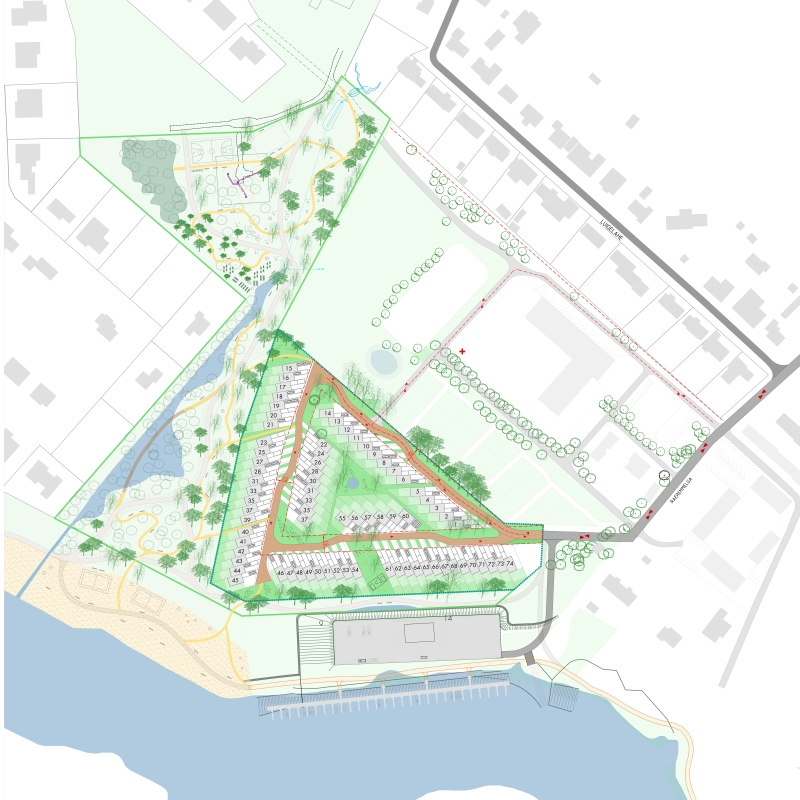
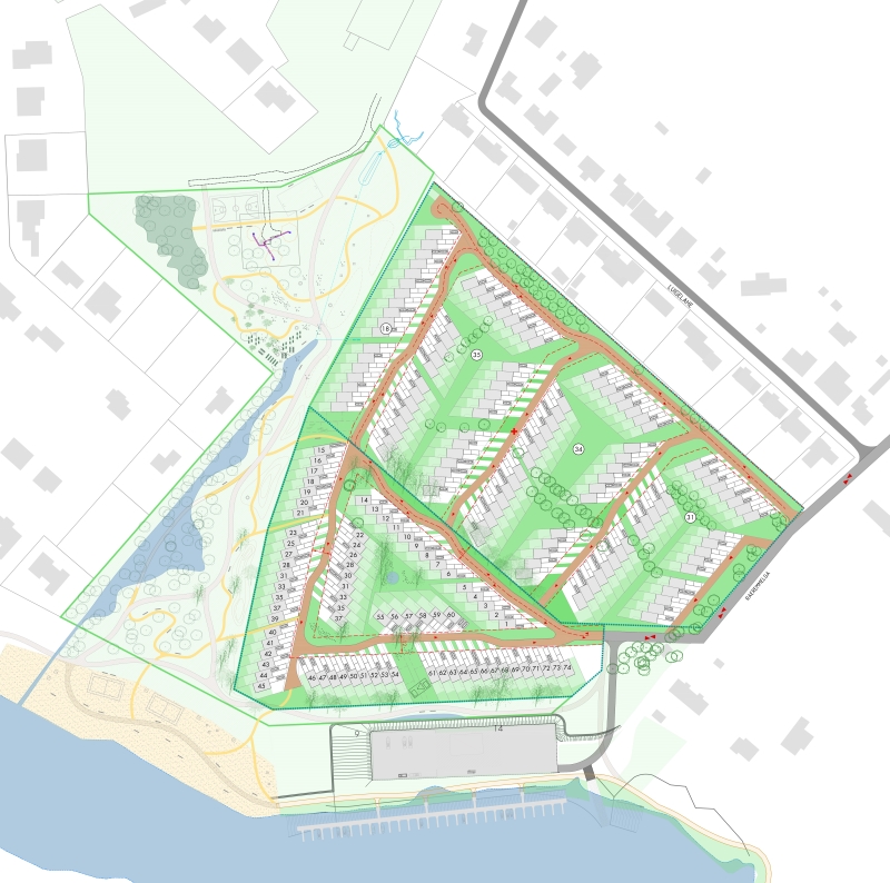
The alignment of parcels along the access road ensures convenient access to the buildings. Rows of plots are interrupted by landscaped public zones accommodating recreation areas, children’s playgrounds and green corridors connecting to surrounding sites.
The first-stage road system is planned in such a way that it is possible to conveniently connect to the internal street system of the second-stage development.
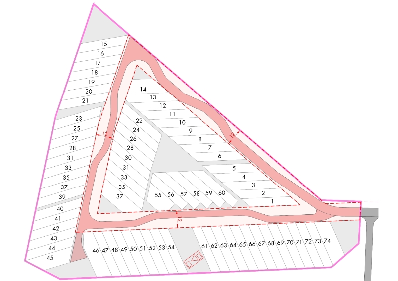
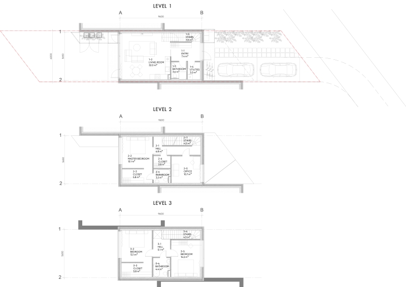
The planned number of building units requires a relatively dense development. A total of 74 plots are planned with 2- and 3-storey residential units, plus one plot for an infrastructure building at the entrance to the area.
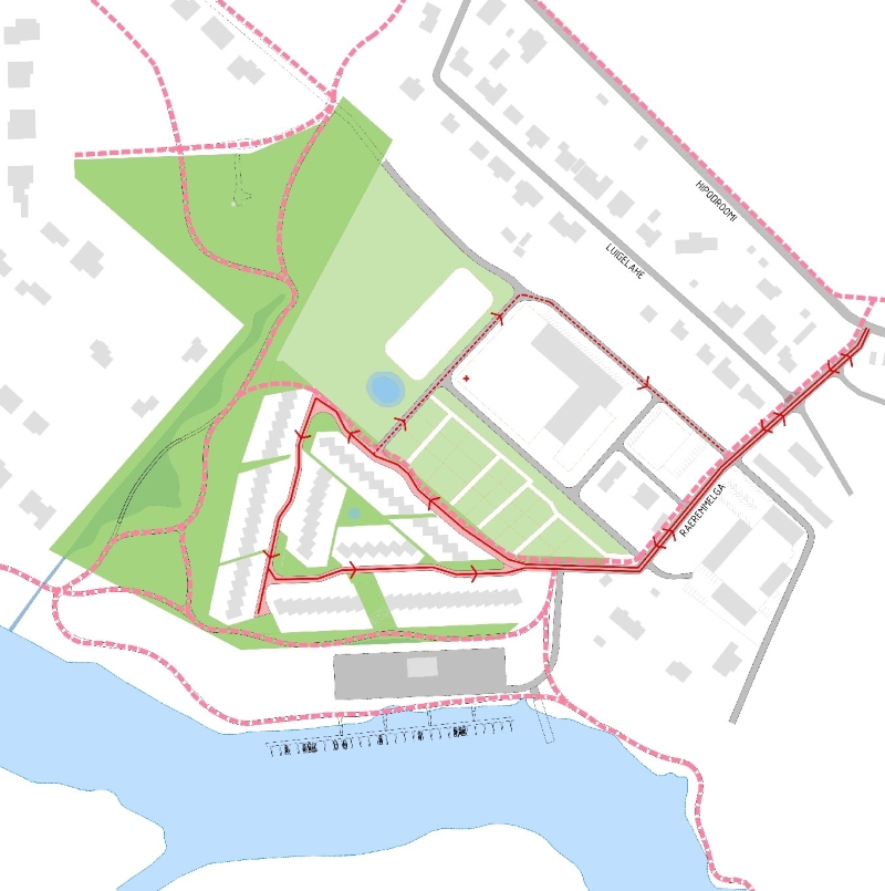
Stage 1 introduces a gently curved one-way shared street aligned with the parcel structure, improving orientation and slowing traffic. Designed within a 12 m-wide corridor, it reduces paved surfaces and creates a greener, less urban character. The street concept includes abundant planting, clinker paving, a 4.5 m shared lane for cars, cyclists and pedestrians, and a 20 km/h speed limit.
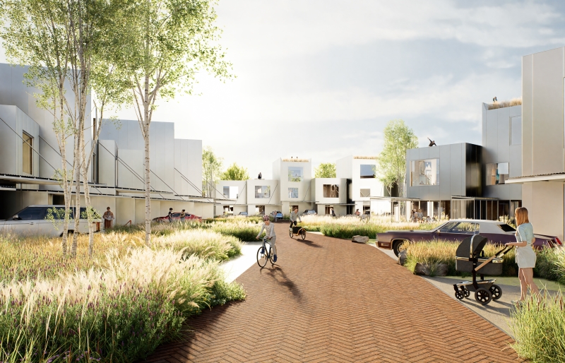
Along the curves of the internal street, intensive planting is proposed within the red line corridor. The green zones separate the individual driveway entrances to each plot from one another.
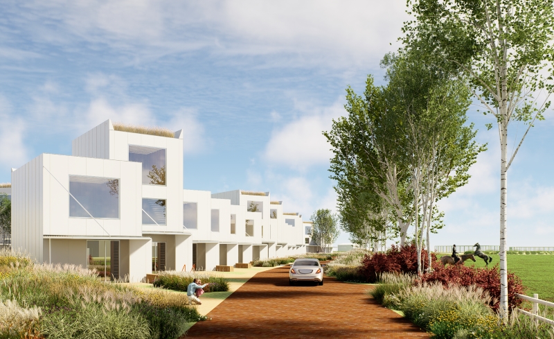
A dense planting strip along the NE boundary provides a buffer against possible odours from horse paddocks.
The “green corridor” system consists of landscaped pedestrian and bicycle paths that connect the central public green space with the surrounding public realm in all directions. It also provides shortcuts to the park area, beach zone and marina. The green corridors are designed with varying widths, creating a diverse spatial and visual experience.
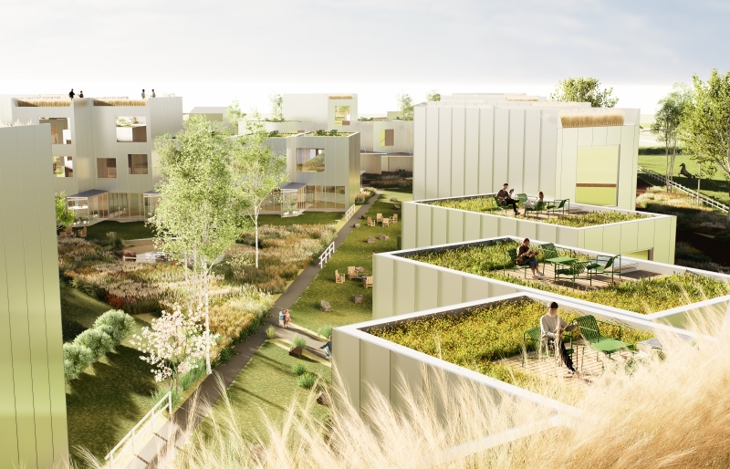
At the centre of the site, a main green space is proposed, featuring a pond / lowered rainwater retention area, abundant planting and landscape elements.
BASIC PRINCIPLES OF ROW HOUSE ARCHITECTURE.
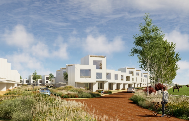
The site is planned with 2- and 3-storey residential units, with 3-storey volumes making up one third of the total number of units. The variation in building heights adds visual dynamism to the row housing composition when viewed from the public open space.
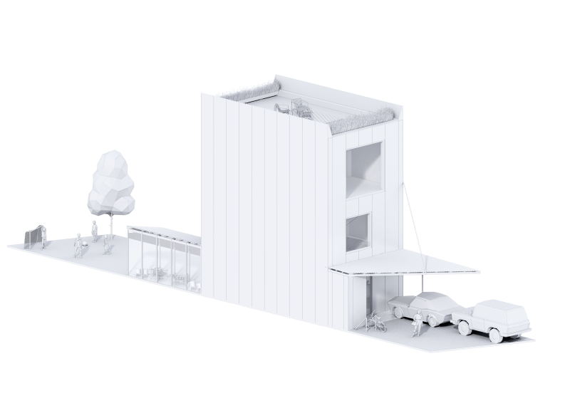
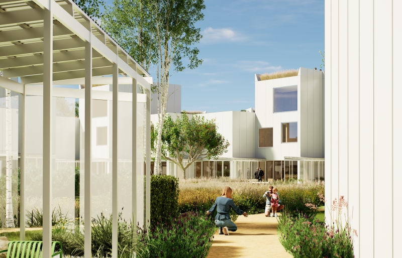
The buildings are placed in the middle of the plot, separating the front yard and the back yard. The front yard has space for 2 cars and bicycles.
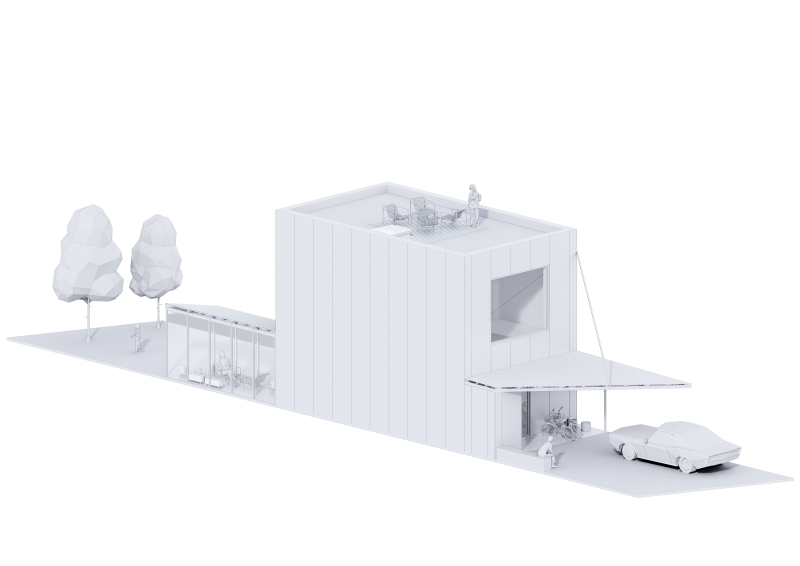 The residential unit is complemented by a glazed veranda / winter garden in the rear yard, providing a connection to the outdoors during cold or rainy conditions. At the same time, the volume of the winter garden offers a degree of privacy from neighbouring units. The residential unit is complemented by a glazed veranda / winter garden in the rear yard, providing a connection to the outdoors during cold or rainy conditions. At the same time, the volume of the winter garden offers a degree of privacy from neighbouring units.
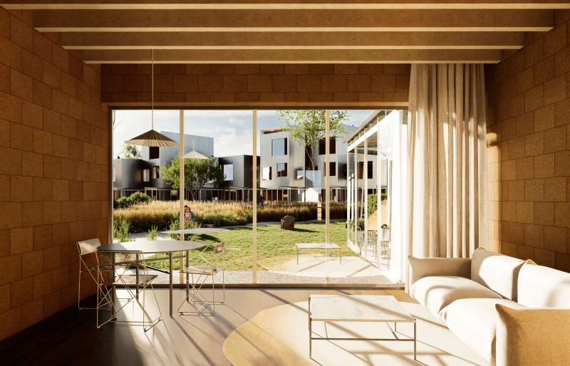
Planned walls made of Keraterm large-sized exposed clay blocks. CLT wood panel coverings provide the necessary structural properties and can be exposed without additional finishing.
|


